Coastal Property Docs creates a detailed visual record of property conditions before mitigation, demolition, repair, or reconstruction changes what can be seen on site.
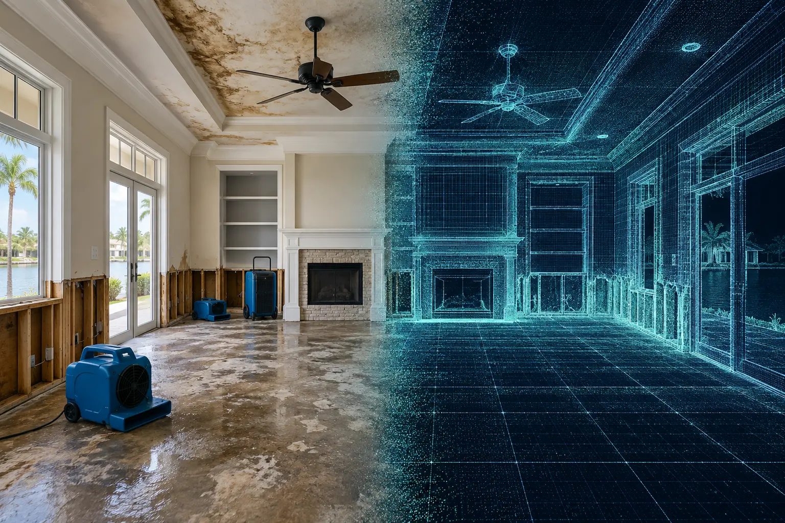
Property losses can change quickly. Water extraction begins, damaged materials are removed, walls are opened, equipment is moved, and reconstruction starts.
Once those changes happen, returning to the original loss condition may no longer be possible.
Restoration documentation creates a visual record of the property at a defined point in time so the condition of the space can still be reviewed later.
Instead of relying only on individual photographs, a digital property record preserves both the visible condition of the loss site and the spatial relationship between rooms and affected areas.
A loss site is constantly changing. The more complete the visual record is before those changes occur, the easier it becomes to understand what was present at the time of capture.
Capture visible damage and property conditions before tear-out or remediation begins.
Return to the captured property without scheduling another physical walkthrough.
Give contractors, owners, adjusters, and other authorized parties a clearer view of the property.
Preserve how rooms, damaged areas, and property features relate to one another.
Use the captured site as an additional visual reference during estimating, planning, and reconstruction workflows.
Answer many later property questions by returning to the digital record instead of the physical site.
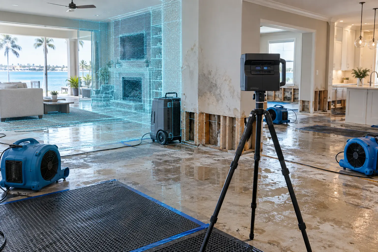
Restoration moves quickly by necessity. But once damaged materials are removed, the original site condition can no longer be physically revisited.
A digital capture can create a persistent visual reference to the property as it existed before those changes.
Documentation can be used at multiple points during the life of a restoration project.
Capture the site and visible conditions near the beginning of the restoration process.
Preserve conditions before damaged materials are removed or the property is significantly altered.
Return to the captured site when reviewing layout, finishes, dimensions, and existing conditions.
A follow-up capture can document completed reconstruction or restored property conditions when requested.
Move through the model and see how a digital twin preserves the spatial context of rooms and property conditions. This type of visual record can remain available after the physical site changes.
Your project scope can include multiple forms of visual and spatial documentation depending on the property and workflow.
Navigate the documented loss site remotely.
Supporting still imagery of documented property conditions.
2D layouts can be provided when appropriate to the project.
Spatial information can supplement appropriate estimating and planning workflows.
Restoration projects often involve people who are not all physically present at the loss site. A digital property record gives authorized stakeholders a common visual reference.
Preserve loss-site conditions and maintain a reference throughout mitigation and reconstruction.
Maintain a clearer visual record of the affected property and documented conditions.
Review documented property conditions remotely when access to the digital record is provided.
Revisit the captured property as an additional reference after demolition or tear-out has occurred.
Use the documented site as a visual reference when reviewing project scope and property conditions.
Better understand the property without requiring every participant to physically visit the site.
We keep the documentation process straightforward so capture can happen quickly when conditions are changing.
Share the property, loss type, site status, timing, and documentation objectives.
We document the included property areas and existing visible conditions.
Captured data is processed into the selected digital twin and supporting deliverables.
You receive access to the completed property record for review and authorized sharing.
Common questions about documenting properties after a loss.
When practical, documentation is most valuable before significant mitigation, demolition, or reconstruction changes the visible condition of the property. Timing depends on access, safety, and the needs of the restoration project.
Potentially, yes. The property must be safe and accessible for capture. Active-loss and emergency requests should be identified when submitting the project so timing and conditions can be reviewed.
In many cases, yes. The appropriate capture setup depends on what needs to be documented and what equipment or materials may obstruct important areas.
Digital twins are useful for remote review and collaboration. Access and sharing can be discussed based on the project and the intended stakeholders.
Not necessarily. The digital twin can complement traditional photographs and other project documentation by adding spatial context and a connected visual reference to the property.
Yes. A follow-up capture can create a separate record of reconstructed or completed conditions when included in the project scope.
Tell us about the property, current conditions, and project timing. For active losses or rapidly changing conditions, identify the project as urgent when requesting your quote.